

Cycling route
Yuma Crossing Bike Path
The official Colorado River Levee Multi-Use Path turns a flat riverfront ride into an open-air museum.
The route
The Yuma Crossing Bike Path—officially the Colorado River Levee Multi-Use Path—runs 3.4 miles along the south bank of the Colorado River through the Yuma Crossing National Heritage Area.
The flat, smooth, paved greenway is an open-air museum on two wheels. It links the East Wetlands, the Territorial Prison, the Ocean-to-Ocean Bridge, Pivot Point, the Quartermaster Depot, and West Wetlands Park. The main path is part of a linked trail network of more than 10 miles.
- Yuma East Wetlands (east end): Starting near the Pacific Avenue Athletic Complex, the trail hugs the levee beside more than 350 acres of restored cottonwoods, willows, and marshes. Early riders often spot great egrets, ospreys, pelicans, and herons.
- Prison Hill and the Ocean-to-Ocean Bridge: Heading west, the path passes beneath the granite bluffs of Yuma Territorial Prison State Historic Park and under both the 1915 Ocean-to-Ocean Bridge and the active Union Pacific railroad bridge into Gateway Park.
- Pivot Point and Quartermaster Depot: Pivot Point Interpretive Plaza and its restored 1907 Baldwin locomotive sit just off the path. Colorado River State Historic Park preserves five original 1860s Army Quartermaster Depot buildings. Bikes must be walked or parked outside the historic grounds.
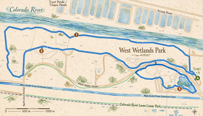
- West Wetlands Park (west end): The route finishes at the 110-acre riverfront park, with Centennial Beach, a hummingbird garden, burrowing owl habitats, and paved inner loops.
Extend the ride
If 3.4 miles is just a warm-up, the Yuma Crossing Bike Path connects to the broader Yuma multi-use trail network. Check City of Yuma trail updates before heading south; canal maintenance occasionally closes segments.
- East Main Canal Path: Near 9th Street and N. 12th Avenue, turn south onto this flat corridor along the historic 1912 Yuma Project irrigation canal toward Desert Hills Golf Course.
- Avenue A Bike Path: Connect from the riverfront onto the paved multi-use path behind Avenue A through central Yuma.
Before you go
The route is flat, paved, and ADA-accessible, but it is shared and exposed. Ride early, carry more water than you think you need, and plan around heat and wind.
Bicycles must be walked or parked outside the historic grounds at Colorado River State Historic Park. Check current trail and canal conditions before you ride.
Questions
Before you go
Where does the Yuma Crossing Bike Path start?
The 3.4-mile route runs between Pacific Avenue and West Wetlands Park. Practical starts include the Pacific Avenue Athletic Complex, Gateway Park, and West Wetlands.
Is the route flat and accessible?
Yes. The path is paved, essentially flat, and ADA-accessible. It is shared with walkers and cyclists.
Can I ride through the state park?
No. Bicycles must be walked or parked outside the historic grounds at Colorado River State Historic Park.
How do I extend the ride?
Connect to the East Main Canal Path near 9th Street and N. 12th Avenue, or the Avenue A Bike Path. Check City of Yuma updates for temporary canal closures.
Last reviewed: November 17, 2026. See our sources and editorial policy.